


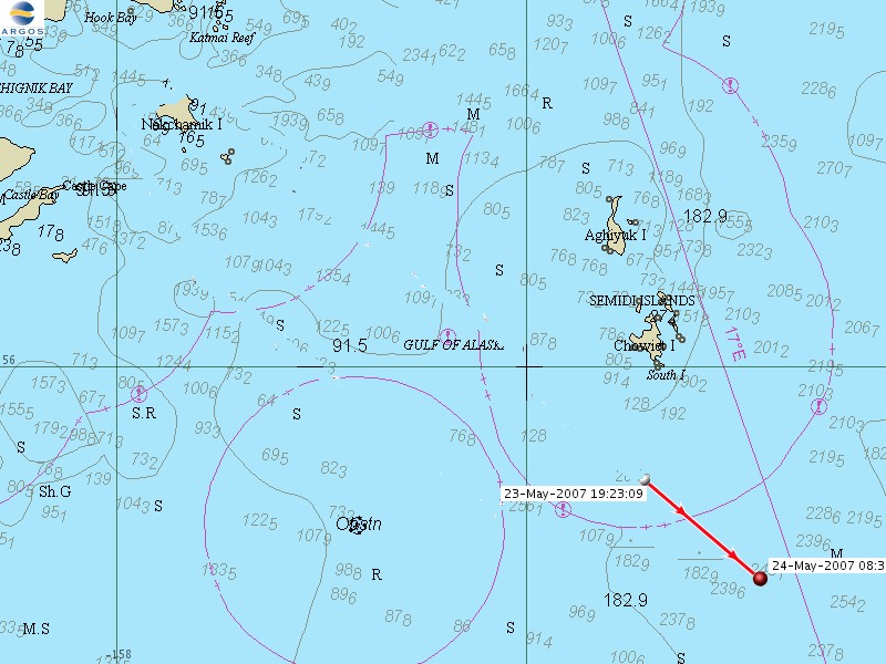
Keep checking here. When the data from our drifter buoy becomes available, we will report it here. In the mean time, you can take a look at the position of the drifter buoys in the Global Drifter Array. Our buoy will become part of this global network for its entire 3 month life. Our data will be reported in two forms, Google Earth and Map Format. One of us will have to download the data and manually post it to this website. We will do this about twice a day. Each day we will post a link to each format, and the time of the latest posting. If you would like to download the free Google Earth program to view the detailed data, click here.
Want to find out more about how the system works? Click here.
Click here for the data when it becomes available
NOTE: All time indicated in the data is Greenwich Mean Time (a 24 hour clock with no AM or PM), where right now the time is:
Want to know the water temperature? Use sensor number 2 or sensor number 4 in the list of sensors. There will be a number. Sometimes, there will be a letter and a number. Just write what you see into the box below and press the submit button. You will see the temperature in centigrade appear to the right.
|
 |
||||||||||
|
|
