
![]()
![]()
![]()
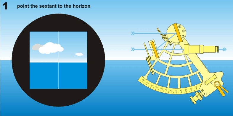
The most sophisticated device used in celestial navigation is the sextant. It uses advanced optics, such as mirrors and lenses and requires complex calculations. Good navigators can use it to determine the latitude to within one mile of their real position.
The sextant was developed in 1788 and was one of the most important navigation instruments for many famous ship captains. Can you name a few?
Many captains still carry a sextant as a backup to modern navigation systems. Can you think why? Click here for a video lesson on using the sextant.
![]()
Try This:
One of the greatest examples of celestial navigation using simple tools was that of Earnest Shackelton. Shackelton was a polar explorer who was trapped over winter on Antarctica. After his ship was crushed by ice, he and 5 crew members took a 22 and a half foot lifeboat and sailed 800 miles for help over some of the most treacherous seas in the world. During the epic voyage, the skies were so stormy that navigator Frank Worsley could only sight the sun 4 times. Still they managed to land on tiny South George Island. Had they missed the tiny island, they, and the rest of the crew stuck in Antarctica would have been lost forever. Would you like to try a simulation of Worsley’s navigation by sextant? Just click here. Remember one important detail: Because the view of the sun was so hazy, and the seas were so rough, Worsley sited the center of the sun, rather than the edge as most sailors do and as this graphic above shows.