


Here is our data from the drifter. Keep watching. Have we finally
hit the Gulf Stream? Are we heading for E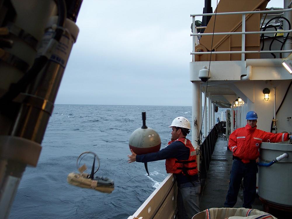 urope?
Scientists often use an instrument called a drifter buoy to measure different things in the ocean. On this cruise, we will be "adopting" a drifter for our school along with some students at the Soul American High School. I released the instrument from the Bigelow on October 9th 2008 at 20:22 Greenwich Mean Time. The position was 40°50'13.74"N by 66°38'32.30"W. As it drifts through the open sea, we will be able to know its location and know the water temperature around the buoy. This buoy will be part of a network of drifters all over the earth that measure how heat and water move through our changing world.
Click Here for a video of the launch!
To find out more about the Adopt A Drifter program from NOAA, just click here.
Find our buoy on the Adopt A Drifter Website! Click here, then click the plus sign by Track By School. Click on our buoy, scroll to the bottom and click Get Information.
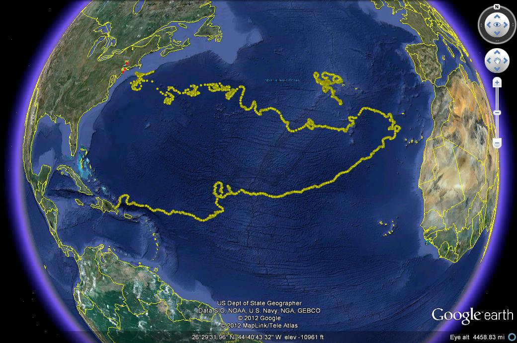
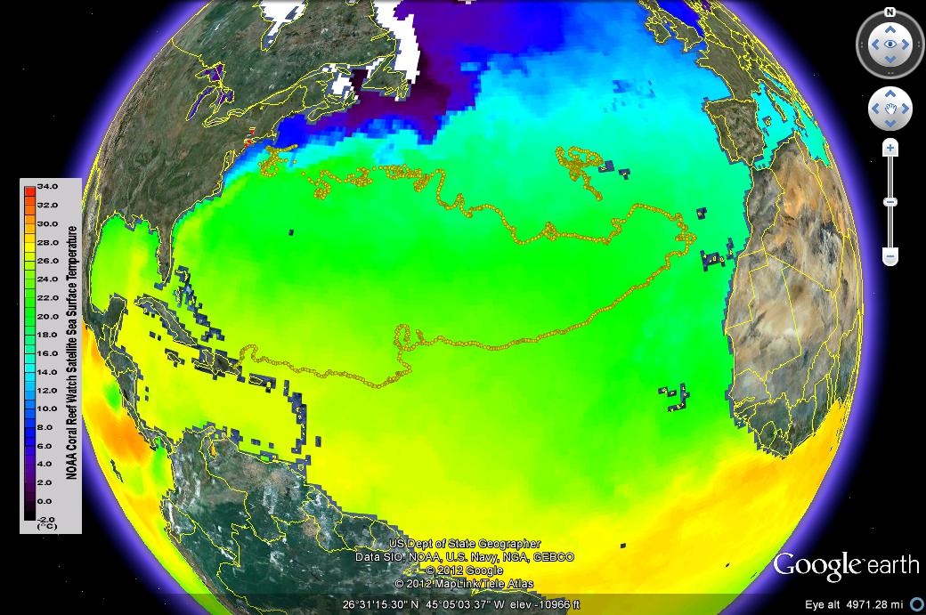
Our Drifter Project is now complete. Our buoy jounried across the entire Atlantic Ocean and back again. It met its end on the shores of the Dominican Republic. Take a look at these two Google Earth projections. One is the path of the bouy itself. The other showes the water temperature. Can you see the currents that carried it? You can download the track for Google Earth Here
  |
Click in the form below to access our drifter data.
Map showing drifter track dates
Table of measurements